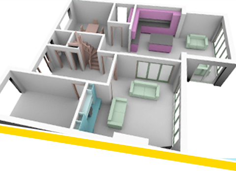
HiBuild Surveys CAD services include large-scale 2D & 3D CAD drafting, paper to CAD conversion, raster to vector conversion, raster to vector conversion for engineering drawings, architectural and facility drawings, contour maps, ground cadastre plans and utility distribution network maps for electric, gas, water, sewage and telecom. HiBuild Surveys skill sets in CAD services include knowledge in drafting, designing and customizing programs in AutoCAD, Bentley Microstation. Specialising in Co-ordination and Drafting Services to Building Services (M&E) Contractors, and Scheme Drafting Services for Architects, Consultants and Electrical Contractors. All of our quality assured services can be accessed in a way that suits you best, including:
“Overflow” service to help with peaks and troughs in your workflow.
Full outsourced service.
Occasional input on individual projects.
“Emergency” quick response support on fast track projects.
Supplementary services such as 3D modeling and visualization.
Our Services 2D + 3D Building Services Coordination 2D CAD Drafting, Record Drawing Verification Surveys.
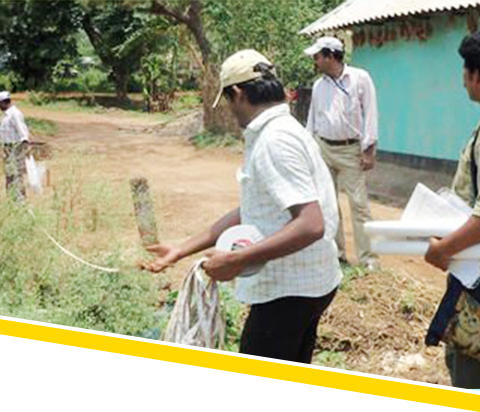
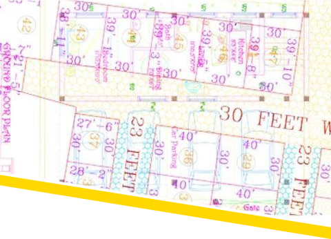
The survey is conducted primarily for the purpose of which is to document the perimeters, or any one of them, of a parcel of land by establishing or re-establishing corners, monuments, boundary lines for the purpose of describing the parcel, locating fixed markers on the parcel and dividing the parcel. The present socio-economic scenario is the focal point of this survey as these help our planner and NGOs in guiding socio-development work.

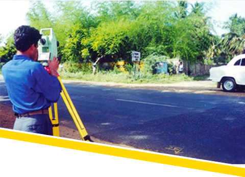
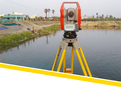
Topographical Survey is carried out by using Total Station Survey Instrument. It does capture AND locate various Topographical Features like building out line, utility buildings, sheds, internal roads, HT Tower and lines, LT poles, Transformer, sub-station, village roads, compound wall, fencing, Telephone lines, EB House, Pump House, well, bore well, ponds, bunds, lake, culvert, irrigation channels, plantation limits, trees, girth & foliage, earth pit, pavement, driveway, UG sump, lawn, storm water drain, drainage, manhole, play grounds, race tracks, and all other visible on ground features at site.
According to the requirements of our customers, we are specialized in providing FMB Service to our honorable customers. These FMB Services (Field Measurement Book) are executed to record the locations and also to identify the habitats present in an area for study purpose. Also, these services are delivered as per the requirements of our clients.

We are ranked amongst the renowned organizations that are engaged in providing the best quality range of DGPS Survey.
Based on the Route sketch of the proposed Road provided by the Client, relevant Road Survey will be carried out by using Total Station Survey Instrument covering the distance of the Road line, and capturing various Topo Featurs falling within the corridor of existing / proposed Road route.
The MSL Location and its value provided by the Client will be transferred to the starting point of the Road route, and arrive at the Levels that existed. Based on this value, the Spot Levels along the entire proposed Road Route will be taken by using the above instrument/Auto Level Survey Instrument and if required, beyond the side ends for a suitable width along the Road Route.
However, if MSL value is not available at the nearby location (though it is a must), an assumed bench mark value at 100m, or as the case maybe, will be taken at the Starting Point of the proposed Road Route and fix the value on any Permanent Structure. Based on this value, temporary Bench Marks (TBM) along the alignment route of the Proposed Road route will be established and fix its respective value.
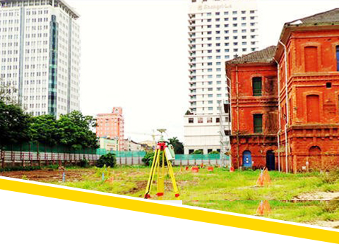
We are the leading entity in the industry, highly engaged in offering the best quality range of Building Survey Services.

Precise leveling is a fast, very cost effective and highly accurate method for detecting even the smallest changes in elevation associated with any site activity. Precise leveling techniques have also been used in testing environments, particularly where the effect of stress on a structure needs to be determined. Strategically placed precise level points can correctly
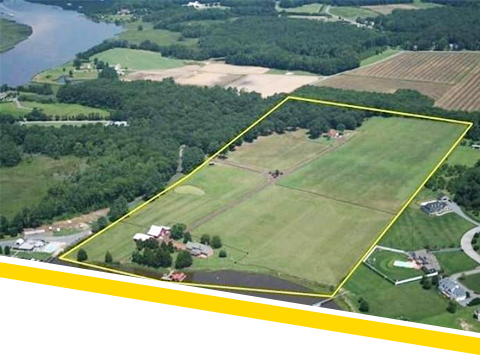
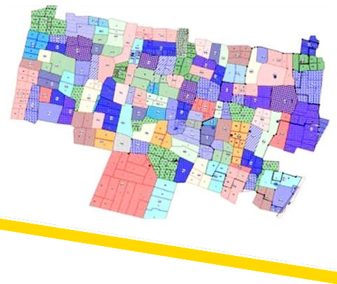
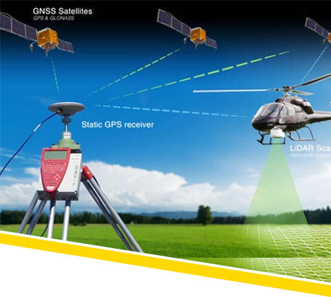
The boundary survey is being carried out on the landed property of a vast area, or wherever required by the Clients, through GPS (Global Positioning System). After arriving at the latitude and longitude coordinates of the location of the relevant site using GPS (Global Positioning System) Instrument, through satellite UTM (Universal Traverse Mercator), the coordinates of X axis and Y Axis of the site would be arrived at. The Datum (i.e., Latitude/Longitude) would be fixed on any permanent locatio at the site. Based on the above datum, the Boundary Survey of the site would be carried out.
The Boundary Survey of the site can also be carried out by using Total Station Instrument based on the Boundaries shown by the Clients by fixing the Magnetic North of the Site. The above instrument gives the correct area of the site with an accurate distance measurement as based on the boundaries shown by the clients. There is bound to have a slight variation in the area from the FMB area, because FMB area is being taken through Chain Measurement.
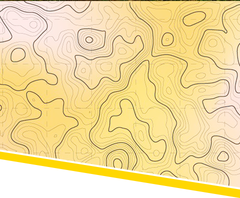
Contour Survey is done to know the exact site terrain condition such as slope direction, heap/depth, etc., (undulation of the site).
The levels will be taken based on the MSL (Mean Sea Level) Bench Mark already Fixed by the Survey of India Authorities that existed in any nearby Location of the Site, like Railway Station, PWD Authorities Office etc., with its value as indicated on a suitable place. This value is identified and furnished by the Clients. The respective value will be transferred to the site Boundary, and based on it the spot levels of the entire site will be taken at relevant interval as required by the Client OR as per Site Condition.
On the other hand, if the MSL value is not available, the Contour Survey of the Site will be carried out by fixing assumed arbitrary Bench Mark value at Site at 100m or as the case may be, and based on the same the relevant Spot Levels will be taken.
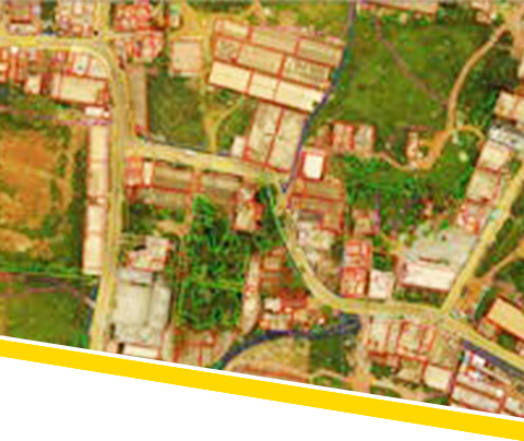
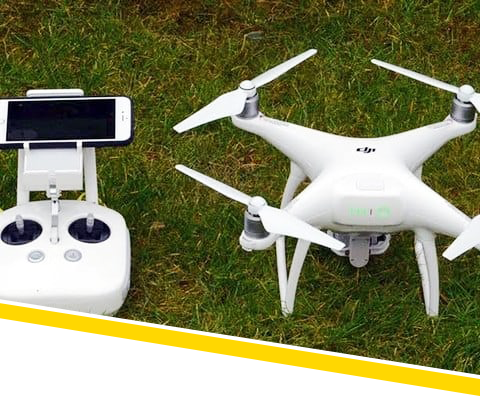
HiBuild Surveys having experience in the professional surveying industry, now specializing in UAV data processing and delivers high quality true ortho photo, Contours / DEM / DTM / DSM and 3D model to various domain urban planning, commercial, utilities, environmental, agriculture and governance. Post processing is performed using very powerful workstations to handle the massive size of the datasets acquired.
UAV Expertise, Stereoscopic orientations, Point Cloud models, Meshes, Digital Surface Model, Digital Terrain Models, 3D vector maps, Orthomosaics, Contour Lines, Radiometric Maps, Aerial Triangulation & Adjustment, Stereo Compilation, Terrain Modeling, DTM Generation, Feature Extraction & Validation, Change Detection, Creation of Digital, Elevation Models, Input Data, Raw image, Camera calibration, GCPs, Projection system and Datum Deliverables, Ortho Photos, Ortho Mosaic, LAS color, Info Projection, DTM, DSM, Item code UAV0006
We are among the reputed organizations, highly engaged in providing an optimum quality range of Lidar Topographic Survey Service.
Our excellent layout survey solutions include boundary surveys, dividing land into plots of desired sizes, road mapping, land approval, topographic mapping and construction staking.
and precisely determine the extent of settlement on any structure.
Our company is engaged in offering Levelling Services that are playing a crucial role in rubble removal and land-filling. These services are handled by experienced industry professionals who hold expertise in perfectly understanding and meeting the specific service requirements of our customers. Our services are highly known for cost effectiveness and timely execution.
We provide City Survey services to clients, which caters widely to highway engineers. With respect to highway surveying with a high point density, we render our services by collecting the data for the same with the help of our highly skilled engineers and professionals. The information that is obtained by us is transferred to our software very easily for the purpose of designing and is presented as a CAD file or hard copy. In order to meet the varied requirements of our clients.
Leveraging on our huge industry understanding and knowledge, we are providing Canal Survey Service. These provided services are delivered by well-trained professionals as per set industry guidelines. Due to its perfection and promptness, this service is broadly valued by our clients.